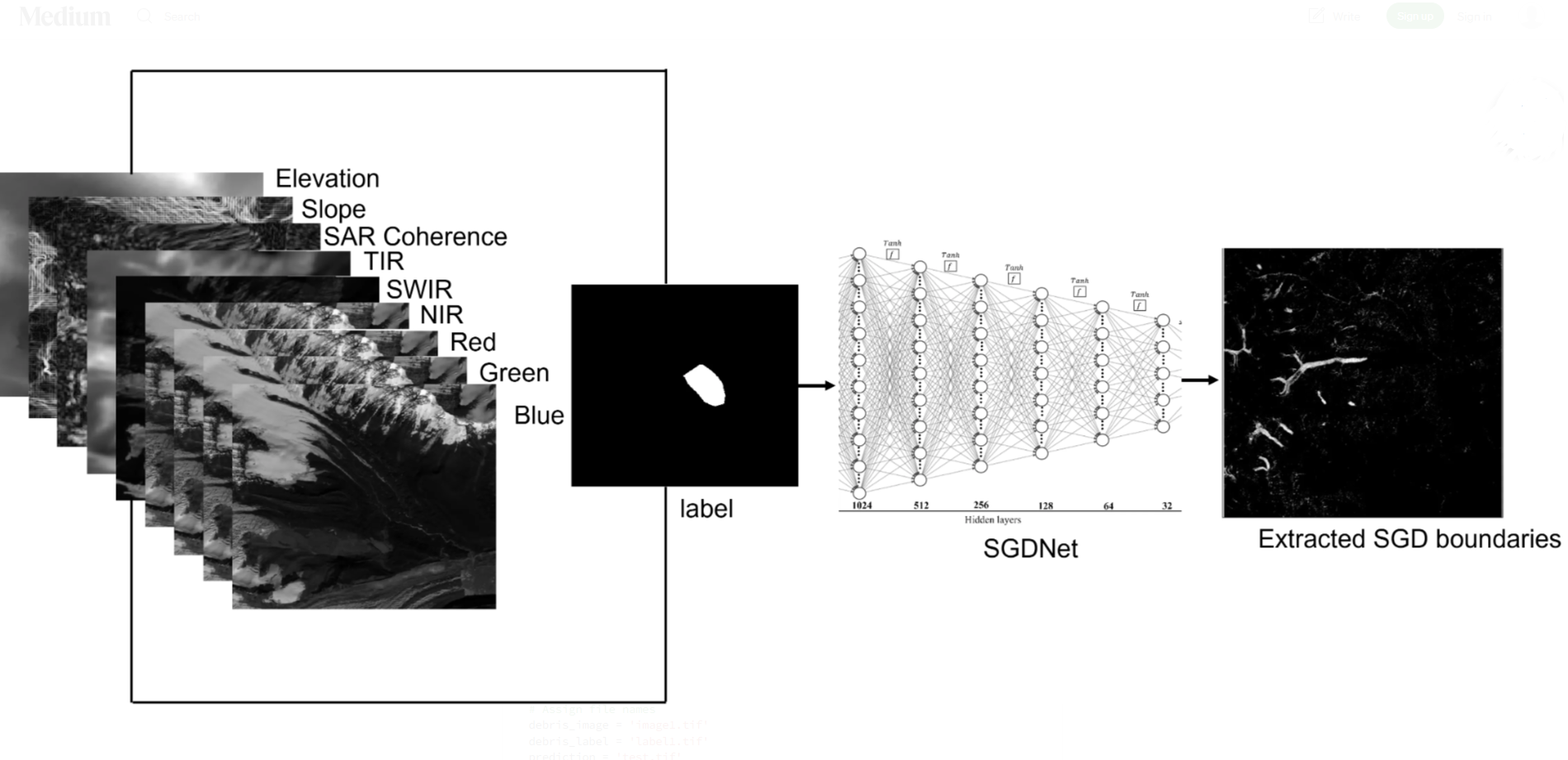
This blog provides a step-by-step implementation of deep learning using multisource remote sensing data for extracting glacier boundaries (specifically supraglacial debris, which is referred to as glacier boundary throughout the post, as mapping of clean ice is quite straightforward using NDSI) in parts of the Himalaya-Karakoram (HK). This blog is equally relevant to all GeoAI enthusiasts who are interested in Earth Observation (EO) applications using deep learning. The code and explanation provided here are easy to adapt for other EO applications. The original data and code of this work can be accessed via Repository Link.
Figure: Example of deep learning-based glacier mapping using multisource remote sensing data.
Read full blog here guide The intersection of computer vision, remote sensing, and earth observation has proven to be highly effective in monitoring and predicting Earth surface processes. These tasks often require combining multisource remote sensing data to provide complementary information to deep learning models. Since these models are data-intensive, performing large-scale analyses necessitates a sophisticated pipeline for downloading and processing multisource remote sensing data efficiently.
In this blog, I have share Python code snippets to download various remote sensing datasets, including Sentinel-1, Sentinel-2, MODIS, Digital Elevation Model (DEM), and precipitation data. The focus is on minimizing prerequisites — such as the need for multiple accounts — while offering flexible solutions to work with different areas of interest (AOI). Repository Link.