
Datasets
Long-term GWSA Trend over the Indus Basin
Link: Zenodo — Indus Basin GWSA Trend
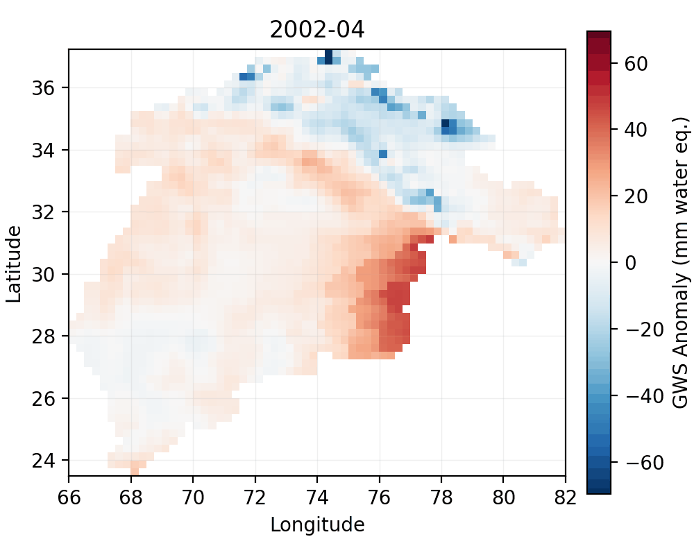
Provides trend estimates and supporting layers for hydrogeologic analysis over the Indus Basin.
Gap-Filled GRACE/GRACE-FO Dataset
Link: Zenodo — Gap Filled GRACE Dataset
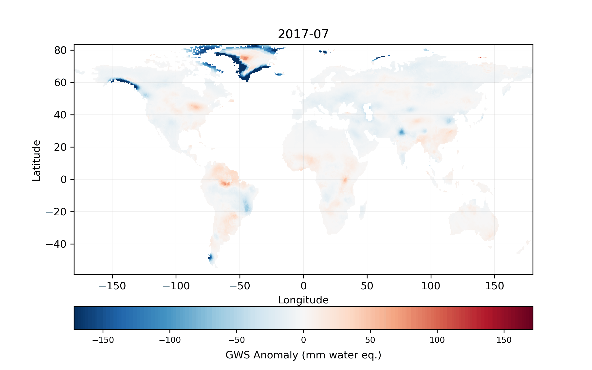
A harmonized and gap-filled GRACE/GRACE-FO dataset suitable for basin-scale hydro-climate analysis and trend detection. Include processing notes, resolution, and units here if you want.
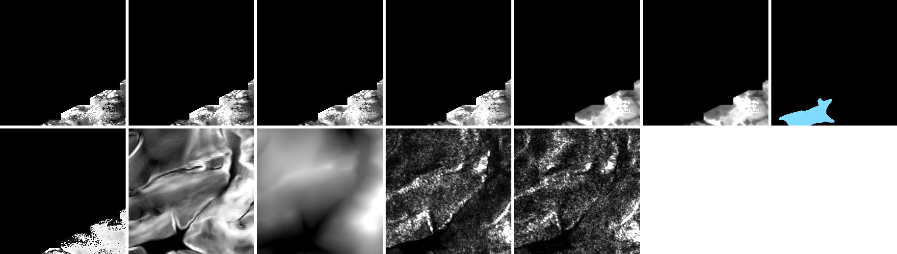
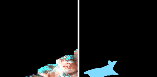
Debris-Cover Glacier Training Dataset
Link: Zenodo — Debris Cover Glacier Dataset
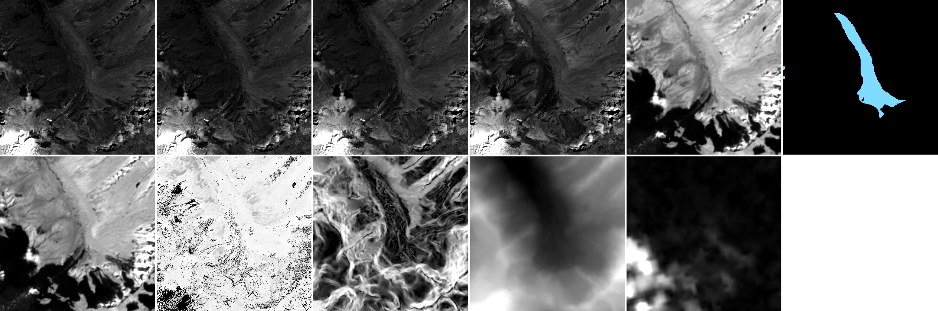
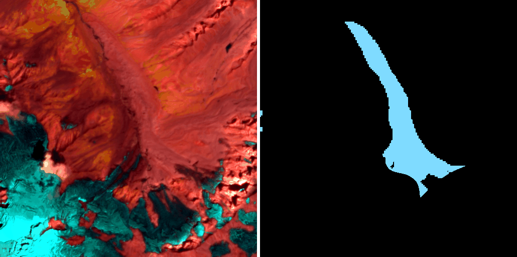
Curated multispectral chips, labels, and splits for training and benchmarking deep learning models on debris-covered glacier detection.
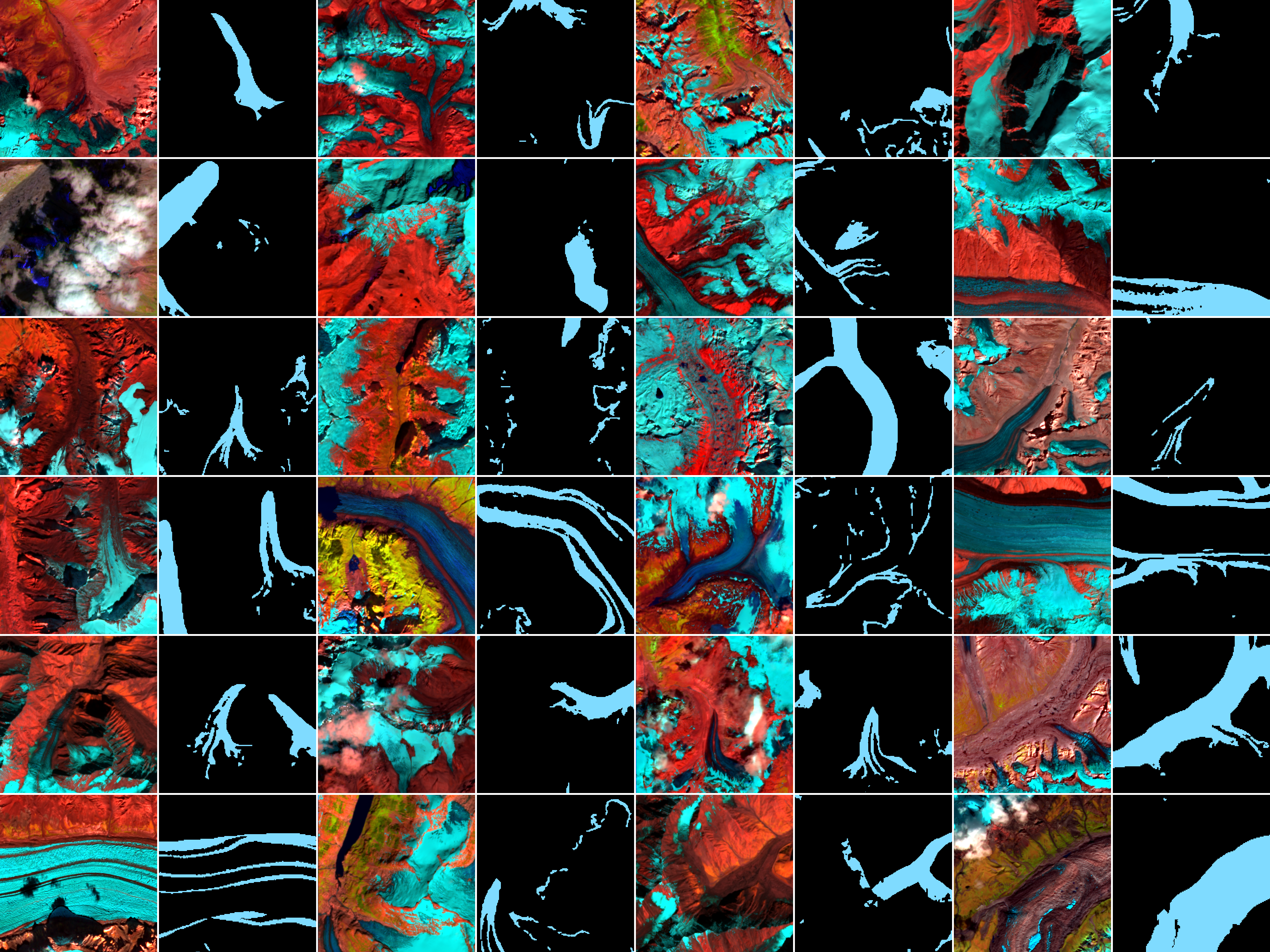
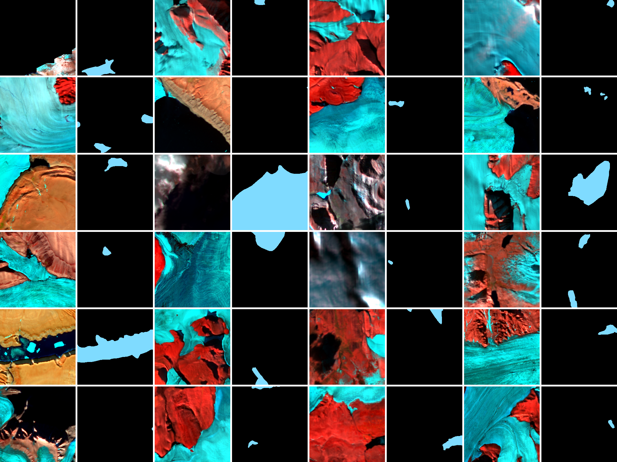
Glacial Lake-Bench
Status: Zenodo — Glacial Lake Bench
| RGI Region | No. Images | Total Lake Area (km²) | Area Covered by Dataset (km²) | % Area Covered |
|---|---|---|---|---|
| Alaska | 3,323 | 3,549.55 | 3,174.64 | 89.42% |
| Iceland | 65 | 306.50 | 35.78 | 11.67% |
| New-Zealand | 133 | 393.67 | 87.43 | 22.21% |
| North Asia | 261 | 467.02 | 299.75 | 64.15% |
| Scandinavia | 595 | 1,840.02 | 351.08 | 19.08% |
| Svalbard | 487 | 278.30 | 219.05 | 78.71% |
| Arctic Canada | 1,558 | 767.37 | 583.21 | 75.99% |
| Arctic Canada South | 1,074 | 2,567.49 | 1,112.91 | 43.36% |
| Central Asia | 1,982 | 921.79 | 600.95 | 65.20% |
| Central Europe | 521 | 156.84 | 63.92 | 40.77% |
| Greenland | 2,287 | 5,725.42 | 3,775.64 | 65.94% |
| Low Latitude | 412 | 524.83 | 116.06 | 22.11% |
| Middle East (Caucasus) | 97 | 6.31 | 3.81 | 60.37% |
| Russian Arctic | 344 | 420.33 | 152.12 | 36.19% |
| South Andes | 2,077 | 3,329.34 | 802.32 | 24.09% |
| South Asia East | 638 | 649.21 | 59.80 | 9.21% |
| South Asia West | 1,684 | 283.99 | 223.88 | 78.81% |
| Western Canada | 1,612 | 2,107.74 | 296.66 | 14.07% |
Curated, multi-sensor dataset for glacial lake detection and segmentation. Includes Sentinel-1 (VV, VH), Sentinel-2 (Blue, Green, Red, NIR, SWIR-11, SWIR-12), NDWI, DEM, and slope. Designed for training and benchmarking geo-foundational and segmentation models.
Cryo-Bench
Dataset: 🤗 Hugging Face — Cryo-Bench

Cryo-Bench is a benchmark dataset designed for evaluating **Geo-Foundation Models (GFMs)** on cryosphere applications. It contains curated multispectral satellite image chips, corresponding segmentation labels, and standardized train/validation/test splits. The benchmark covers multiple cryosphere tasks including:
- Debris-covered glacier mapping
- Glacial lake segmentation
- Sea ice classification
- Calving front detection