
DL4EO: A Unified Python Framework for Preparing Multi-Source Remote Sensing Data for any Segmentation Task
Published:
Status: Under-Review
Abstract
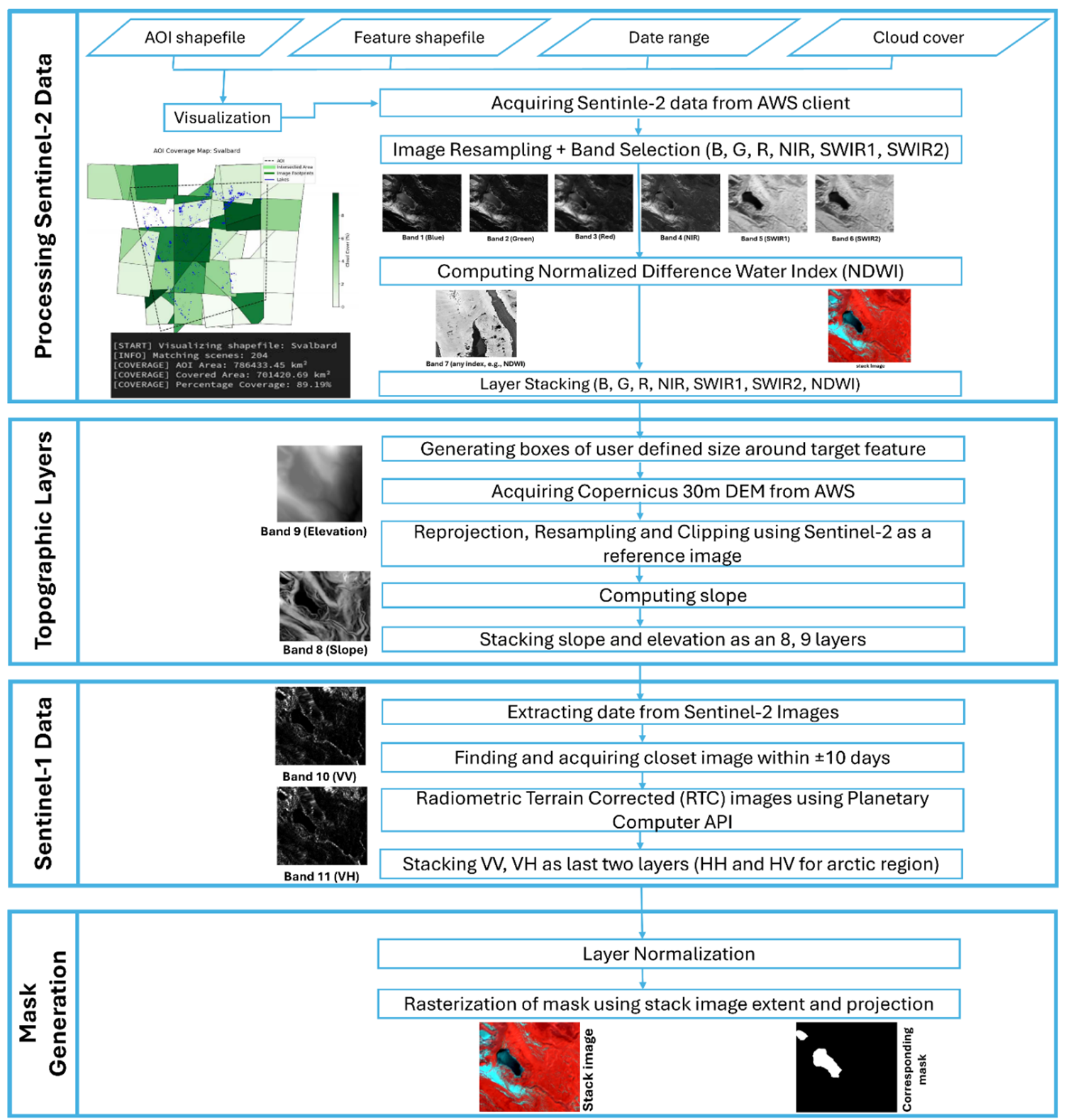
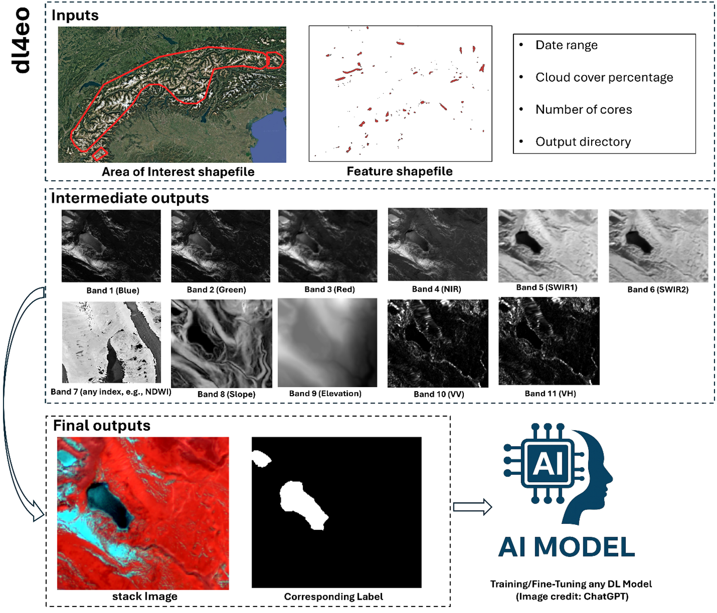
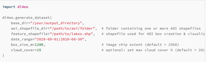
Deep Learning (DL) has transformed Earth Observation (EO) tasks such as vegetation mapping, building detection, and water body monitoring by enabling fast and reliable spatiotemporal analysis. Yet, global-scale applications remain limited due to the un-availability of readily available datasets and complexity involved in processing planetary scale datasets. To address this, we present DL4EO, a Python package that simplifies the preparation of remote sensing data for deep learning. It automatically downloads and processes Sentinel-1 (RTC), Sentinel-2 (Level 2C), and Copernicus DEM data, generating consistent image-label pairs of user-defined size without requiring credentials. As an input, package requires a base directory, date range, cloud cover threshold, area of interest (AOI), and a shapefile of the target feature. To acquire Sentinel-1 RTC data, DL4EO selects the closest available image based on the corresponding Sentinel-2 acquisition. It handles projection, resampling, and alignment to produce globally consistent datasets. The final output consists of user define size (e.g., 256×256) images with 11 bands: Blue, Green, Red, NIR, SWIR1, SWIR2, spectral band (e.g., Normalized Difference Water Index: NDWI), Slope, Elevation, VV, and VH and corresponding label mask, target feature with pixel value 1 and rest 0. This fully automated dataset preparation pipeline supports scalable and efficient deep learning applications in Earth observation.
Recommended citation: Kaushik, S., Tellman, B. (2025). DL4EO: A Unified Python Framework for Preparing Multi-Source Remote Sensing Data for any Segmentation Task. (Under-Review).
Download Paper