
Debris covered glacier mapping using newly annotated multisource remote sensing data and geo-foundational model
Published in Science of Remote Sensing, 2025
Abstract
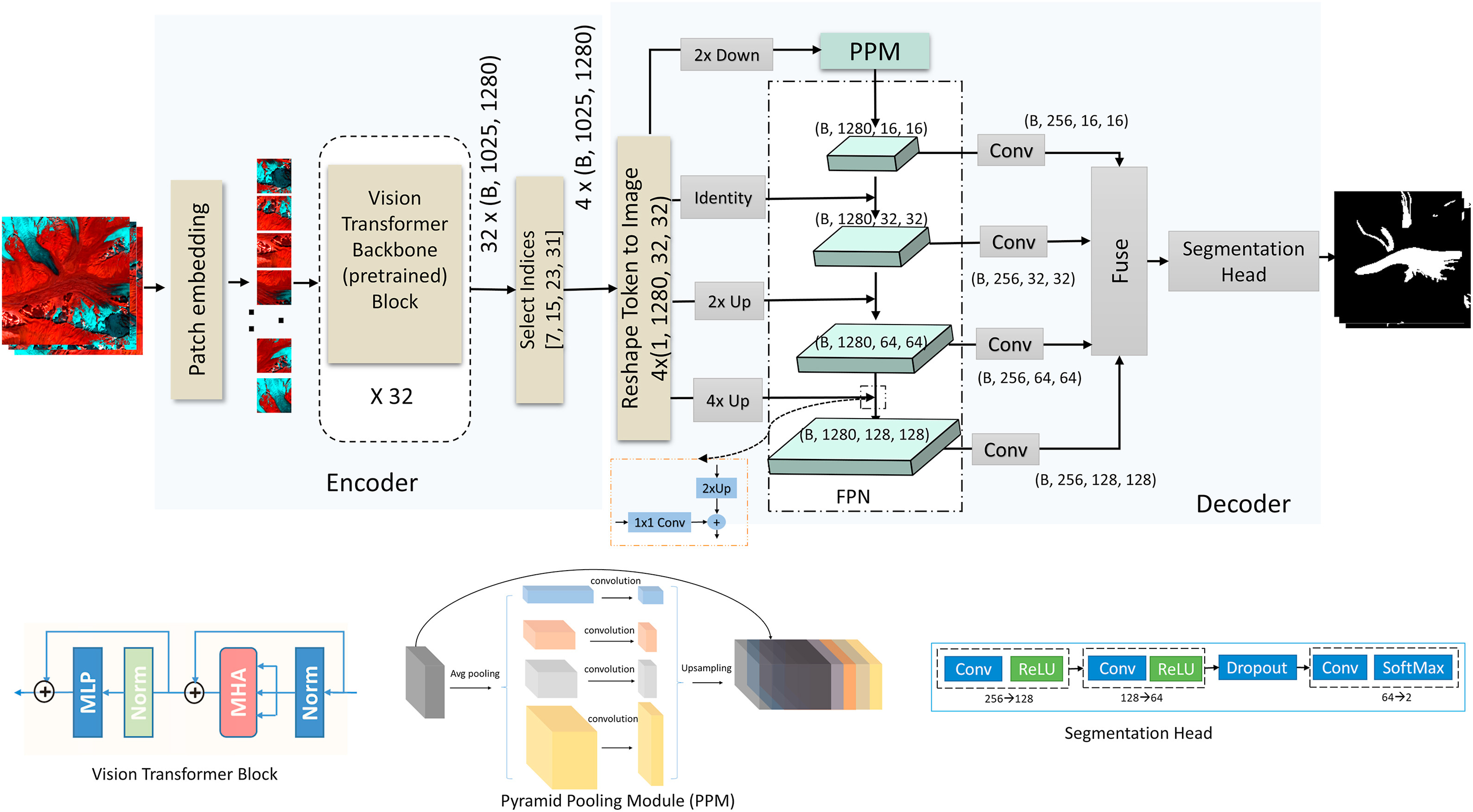
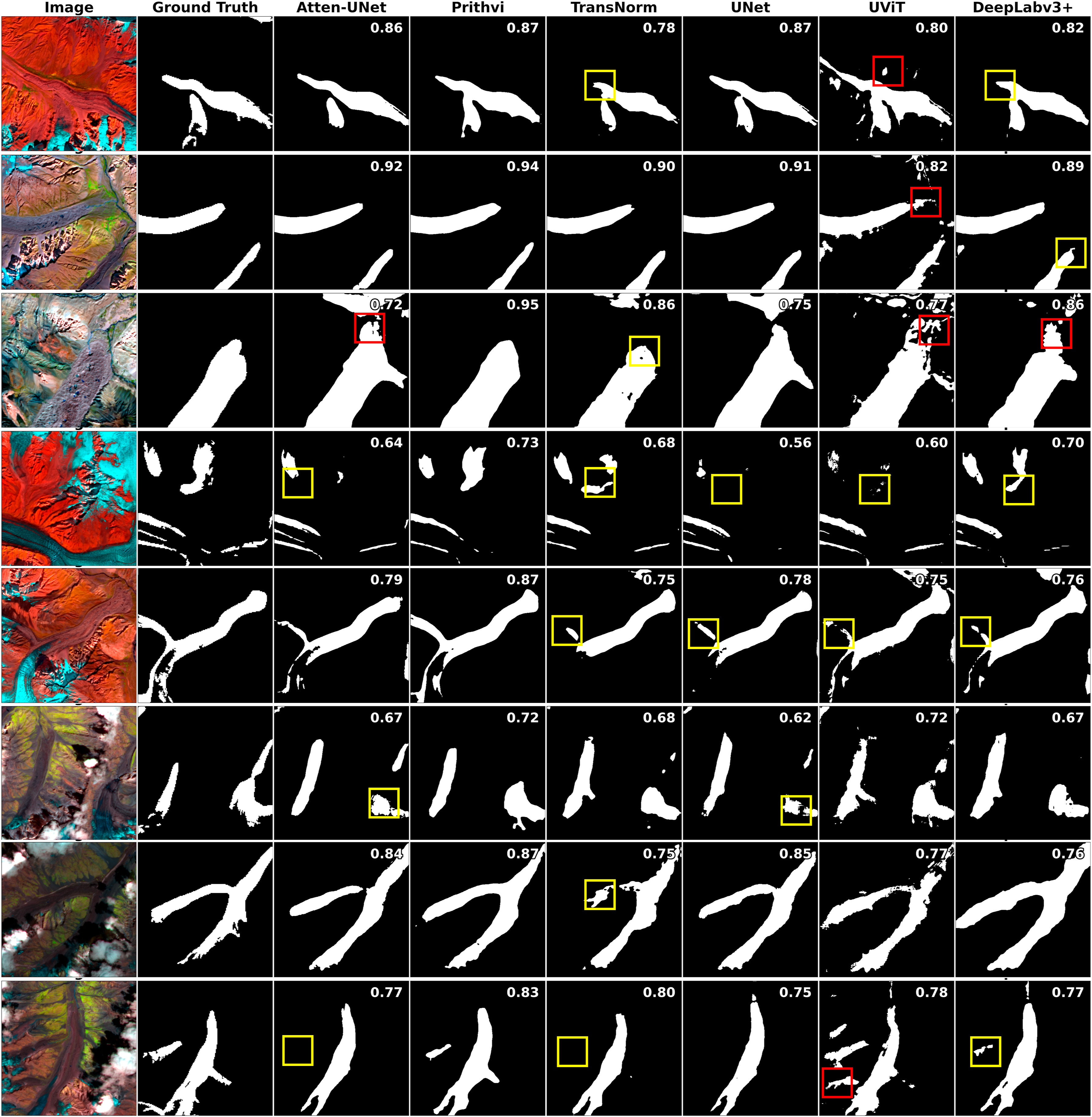
The automated mapping of debris covered glaciers remains challenging due to spectral similarity between supraglacial debris (on-glaciers) and periglacial debris (off-glaciers). Deep learning offers promising capabilities, yet the lack of high-quality publicly available datasets and limited exploration of optimal model architecture constrain progress in this domain. To address this, we introduce the Global Supraglacial Debris Cover Dataset (GSDD), consisting of 1876 images (∼49,000.00 km2) collected globally from diverse glacierized regions, including High Mountain Asia, Andes, Western Canada, Alaska, and Swiss Alps, to incorporate the heterogeneity of glacial features and environments. This multisource remote sensing dataset includes 10 spectral bands—Blue, Green, Red, Near-Infrared, Shortwave Infrared (SWIR1 & SWIR2), Normalized Difference Rock Index (NDRI), Slope, Elevation, and Velocity—providing critical information to distinguish glacier debris. To evaluate the efficacy of deep learning models for mapping glacier debris, we compare Prithvi Geo-Foundational Model (GFM) combined with multiple decoders, CNN-based models (UNet, Attention U-Net, and DeepLabv3+), a Vision Transformer-based model (TransNorm), and variant of the Prithvi GFM (i.e., UViT). Our results show Prithvi GFM with UperNet decoder outperformed all, achieving mIoU = 0.80 and F1-score = 0.91, surpassing DeepLabv3+ (0.71 mIoU), Attention U-Net (0.73), U-Net (0.72), TransNorm (0.71), and UViT (0.70). Our results demonstrate significant methodological advances in accurately mapping glacier termini, along with the identification of glacier snouts. Feature analysis identified the optimal band combination (B-G-NIR-SWIR-Slope-Elevation) for debris mapping. The GSDD dataset enables direct comparison, development, and evaluation of deep learning models, supporting advancement in fast and reliable automated glacier mapping.
Recommended citation: Kaushik, S.*, Maurya, L., Tellman, E., Zhang, G., & Dharpure, J. K. (2025). Debris covered glacier mapping using newly annotated multisource remote sensing data and geo-foundational model, Science of Remote Sensing https://doi.org/10.1016/j.srs.2025.100319
Download Paper