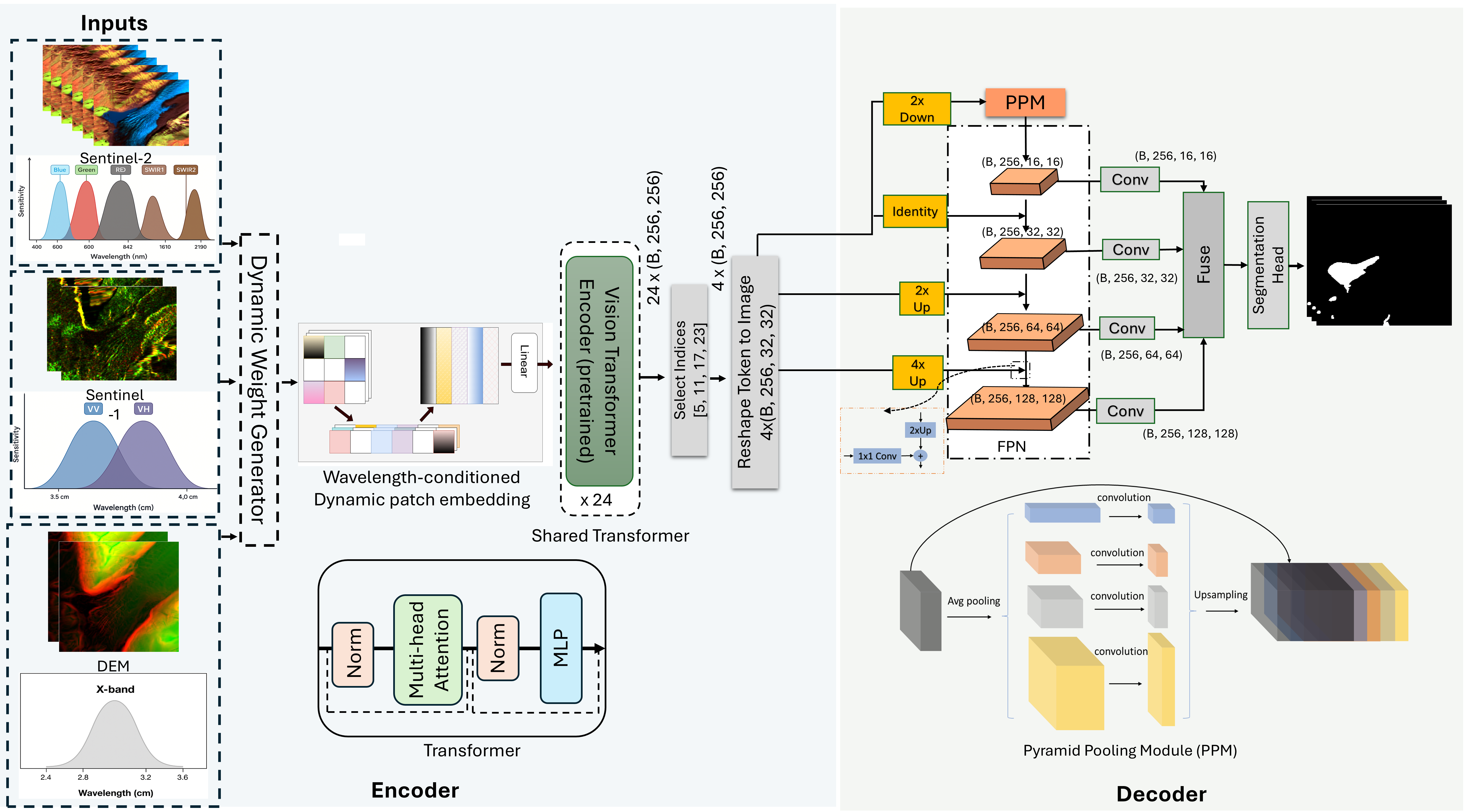
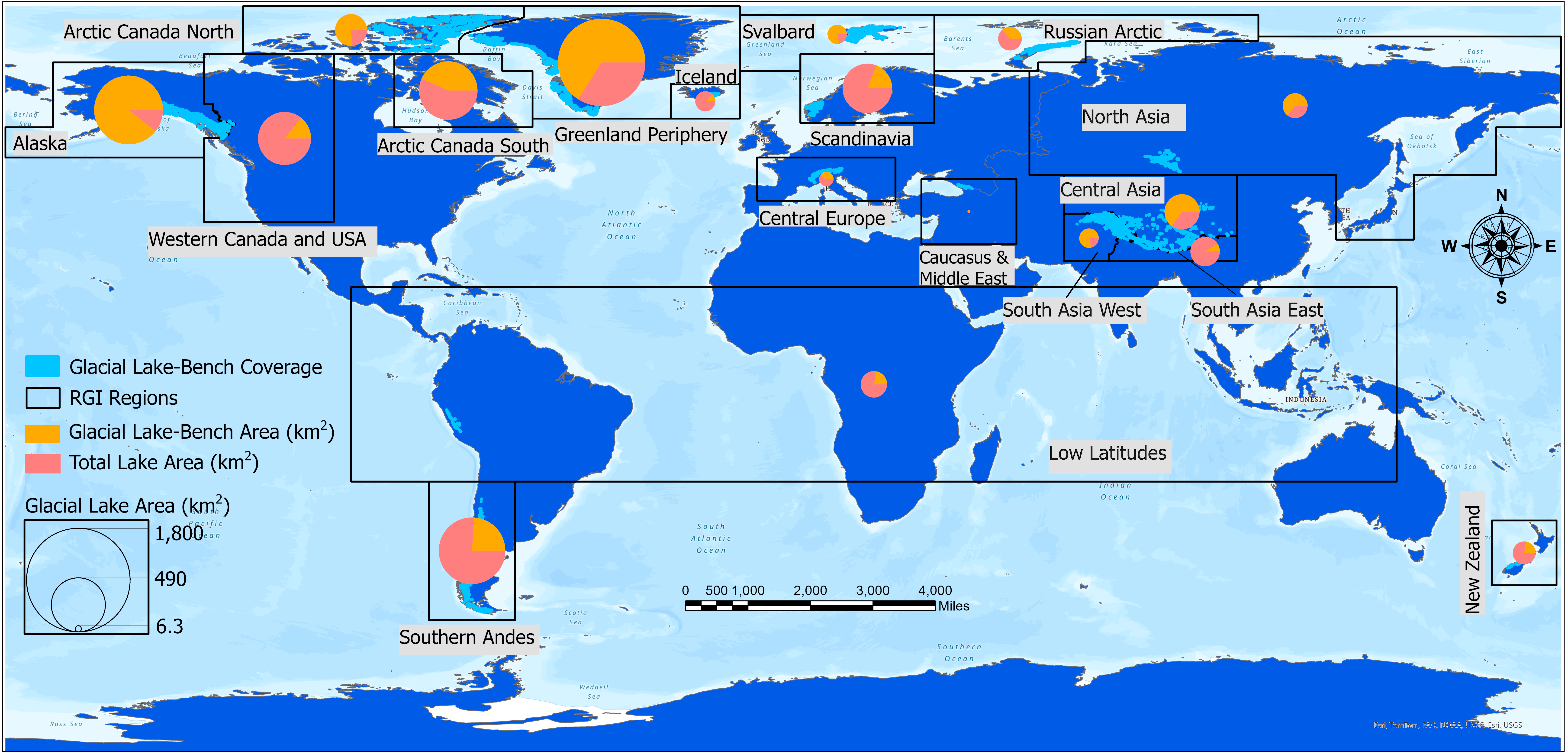
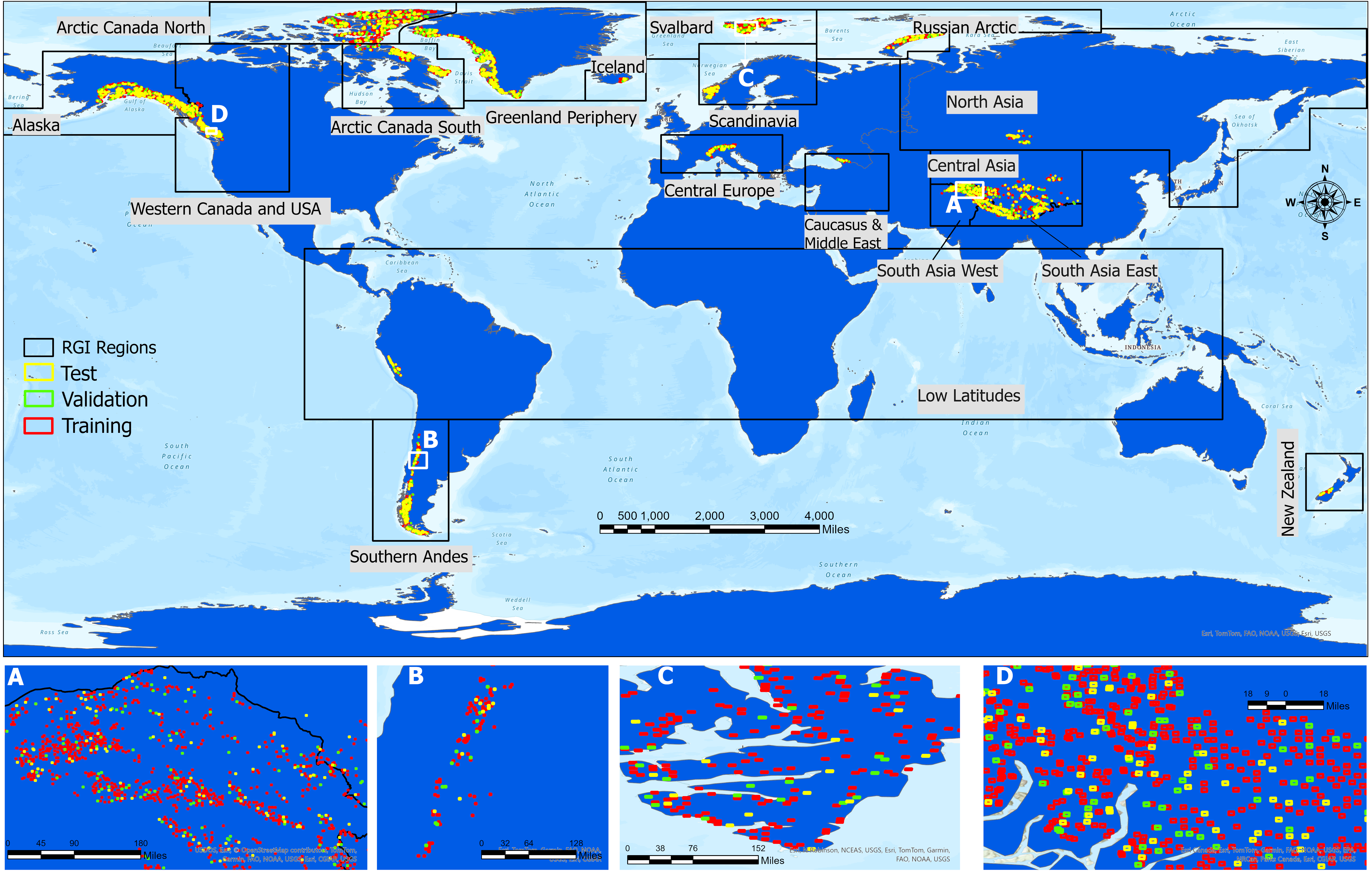
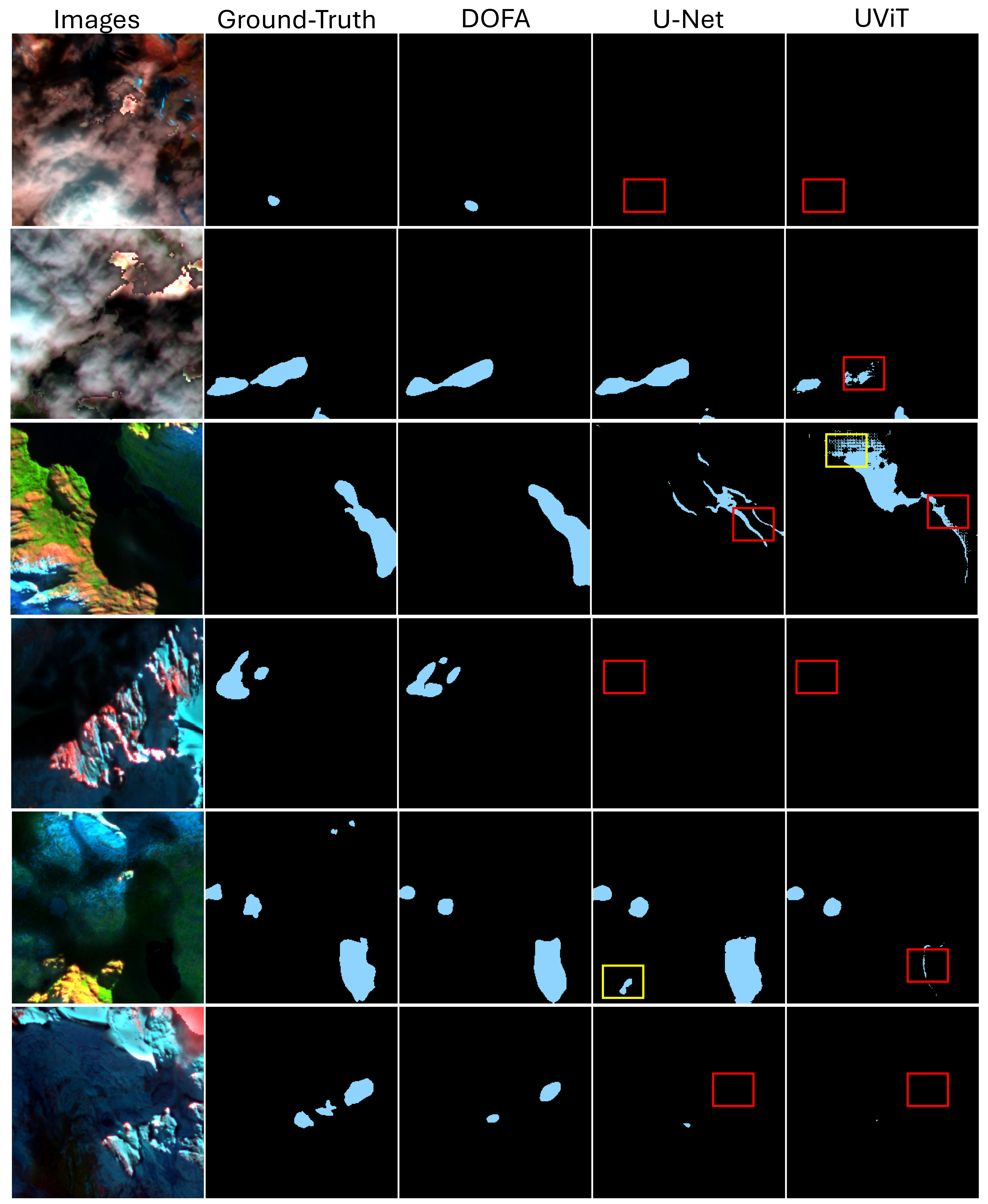
Figure: Schematic illustration of fine-tuning DOFA geo-foundational model for glacial lake mapping using Glacial Lake-Bench. Figure: Compilation of Glacial Lake-Bench across RGI regions. GLB consists of Sentinel-1 (VV, VH), Sentinel-2 (Blue, Green, Red, NIR, SWIR-11, SWIR-12, NDWI), and topographic layers (slope, elevation). The map shows the ratio between total lake area reported by Zhang et al. (2024) and lake area covered by GLB. Figure: Spatial distribution of training, testing, and validation sites globally. Figure: Example DOFA results on the Glacial Lake-Challenge set: clouds, frozen lakes, shadows, and very small lakes (panel e).
Recommended citation: Kaushik, S., Tellman, B., Howat, I., Haritashya, U. (2026). Beyond Clouds: Global glacial lake mapping combining Sentinel-1 and Sentinel-2 remote sensing data and a geo-foundational model. Earth System Science Data (ESSD). https://doi.org/10.5194/essd-2026-474 Download Paper