
FloodDuo: A Dual Foundation-Encoder Architecture for Generalizable High-Resolution Flood Mapping
Published in ISPRS Journal of Photogrammetry and Remote Sensing, 2026
Status: Published in ISPRS Journal of Photogrammetry and Remote Sensing · Code · Model (Hugging Face)
Abstract
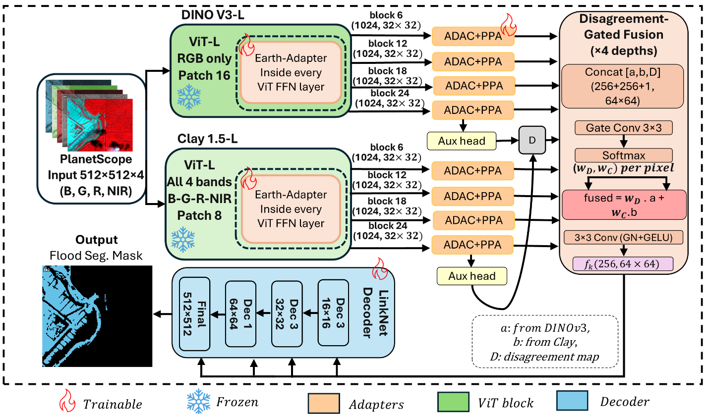
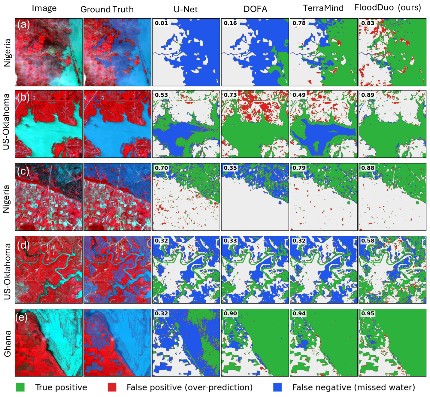
FloodDuo maps open water in high-resolution (3 m, 4-band B/G/R/NIR PlanetScope) post-flood imagery by pairing two frozen vision foundation-model encoders that carry complementary information: DINOv3-L (RGB) for sharp spatial/boundary detail, and Clay v1.5 (all four bands) for wavelength-conditioned spectral discrimination. Each frozen backbone is adapted with lightweight trainable modules — an in-block frequency-domain Earth-Adapter, plus post-hoc atrous-convolution and pyramid-pooling adapters — and the two branches are merged through a disagreement-gated fusion whose per-pixel Jensen-Shannon divergence doubles as a label-free reliability map, before a LinkNet decoder produces the full-resolution mask. Only ~65M parameters are trained against ~614M frozen. Evaluated under leave-one-region-out cross-validation across 19 FloodPlanet regions and 14 Urban Flood Observation (UFO) event sites — a protocol that exposes the cross-region generalization gap a conventional random split hides — FloodDuo achieves 0.728 IoU on FloodPlanet and 0.819 IoU on UFO, outperforming the strongest single-encoder geospatial foundation model baseline by 2.8–3.0 points and a from-scratch U-Net by 3.7–8.0 points.
Recommended citation: Kaushik, S., Tellman, B., Weng, Q. (2026). FloodDuo: A Dual Foundation-Encoder Architecture for Generalizable High-Resolution Flood Mapping. ISPRS Journal of Photogrammetry and Remote Sensing. https://doi.org/10.1016/j.isprsjprs.2026.10.041
Download Paper